AB RANGER 007
Active VIP Member
No it does not. The Backroad GPS Maps have more Smowmobile Trails on their Softwear, but you cannot find a softwear program that has complete trail data. The information that the Backroad Outdoor Recreation Maps show have been supplied to them from USERS of the system. Some Clubs supply this data openly for their trail system and others do not. Take out out a membership to get the info???
 .
.
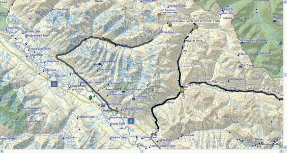
If you have a Garmin MapSource CD/DVD installed in/on your computer you can receive direct data from anyone that has similar software via eMail to your program, them you can, save/it,print it/or trash it. I will attach a pic/jpeg of a trail that I road in 2005 just East of the McBride area. and have since added some Tracks and Waypoints. This area is known as the back door to the Renshaw Cabin via the Holmes River/Chalco Creek.
Bruce.
 .
.If you have a Garmin MapSource CD/DVD installed in/on your computer you can receive direct data from anyone that has similar software via eMail to your program, them you can, save/it,print it/or trash it. I will attach a pic/jpeg of a trail that I road in 2005 just East of the McBride area. and have since added some Tracks and Waypoints. This area is known as the back door to the Renshaw Cabin via the Holmes River/Chalco Creek.
Bruce.

Last edited:


