- Thread starter
- #181
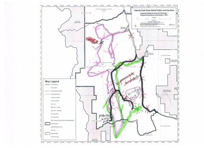
Okay, I have got my scanner working and I am going to post a series of "printable", hand marked maps for the area, for trail users to use. I attached these maps last year and met a number of people on the trails with them. I trust this will help people.
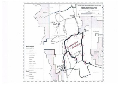
First one: Spray Lakes Sawmill Active Use "roads" in the system - The black lines on the attached scanned map are the currently active roads use by the sawmill to haul out cut logs. The active cutting is finished, but they have a large volume of logs to move. They operate primarily from Monday, to Friday, but depending on availablity of trucks, may operate on a few weekends. THE KEY HERE IS - STAY OFF THESE ROADS, IF THEY ARE PLOUGHED. If the road is not ploughed, that means the trucks are not running. If ploughed, do not drive on as a fully loaded logging truck does not know you are there, and can not stop in time on a "bad corner".

First one: Spray Lakes Sawmill Active Use "roads" in the system - The black lines on the attached scanned map are the currently active roads use by the sawmill to haul out cut logs. The active cutting is finished, but they have a large volume of logs to move. They operate primarily from Monday, to Friday, but depending on availablity of trucks, may operate on a few weekends. THE KEY HERE IS - STAY OFF THESE ROADS, IF THEY ARE PLOUGHED. If the road is not ploughed, that means the trucks are not running. If ploughed, do not drive on as a fully loaded logging truck does not know you are there, and can not stop in time on a "bad corner".

Last edited:


