Hunters Range 2021-2022

tmo1620

Active VIP Member
Joined
Feb 28, 2008
Messages
4,107
Reaction score
8,271
Location
Whitecourt
I get that it’s not the intended purpose of the deck, and he shouldn’t be there parked, but to put out a “ does anyone know these guys, there in big trouble” kinda message implies like they did something against the law or vandalized club property or something. Seems like a no harm no foul kinda thing, if somebody happened to run into those guys something could be said to them no doubt about it, like a “hey someone saw you parked on the deck of the cabin and that’s a no-no” kinda thing, they probably would have no issue with that, but if someone plastered a picture of me up on a sledding forum and a club website for something so trivial I’d be choked. If you were black or native and robbed a convenience store you’d be in less trouble than these guys seem to be lol
 

bendy

Active VIP Member
Joined
Oct 18, 2017
Messages
676
Reaction score
1,309
Location
Spirit River
New sledders? Who gets into mountain riding when they’re in their sixties? The one guy looks like it who is standing by the sled… the guy with the white beard. Sure it looks like a subpar move at best, but who knows why it was done?
 

tex78

Active VIP Member
Joined
Feb 5, 2010
Messages
17,584
Reaction score
17,071
Location
DA Moose B.C
New sledders? Who gets into mountain riding when they’re in their sixties? The one guy looks like it who is standing by the sled… the guy with the white beard. Sure it looks like a subpar move at best, but who knows why it was done?
Lots of new , old sledders


Covid brought out the wood work on new people, that have 0 idea anything , including safety gear ect
 

bendy

Active VIP Member
Joined
Oct 18, 2017
Messages
676
Reaction score
1,309
Location
Spirit River
Lots of new , old sledders


Covid brought out the wood work on new people, that have 0 idea anything , including safety gear ect
I guess… I just thought fear and common sense were in more of an abundance as you got older.
 

blindman

Active member
Joined
Dec 27, 2011
Messages
65
Reaction score
59
Location
coaster
most likely a sled issue. and wtf about old shredders. Im 60 and have been there and respected and tore up a bunch of that terrain. just wait till all you wippersnappers get older!!!! lol
 

ferniesnow

I'm doo-ing it!
Joined
Dec 2, 2008
Messages
113,050
Reaction score
87,061
Location
beautiful, downtown Salmon Arm, BC
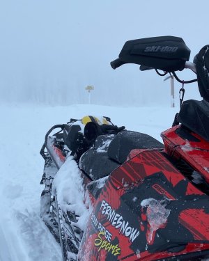
Trails are in great shape. Hats off for the crew as they do an amazing job!

Maybe 30 cm of fresh on the upper trails and pretty much found untracked all day. Brash has more snow on the trail than Ashton.

IMG_6997.jpeg
 

ferniesnow

I'm doo-ing it!
Joined
Dec 2, 2008
Messages
113,050
Reaction score
87,061
Location
beautiful, downtown Salmon Arm, BC
Access is awesome. The little rocks that tick the skis are gone and the trail was baby-butt smooth with another 30 cm of fresh on it. It was what a dude would imagine riding to heaven would be like!

Well over 60 cm if a person knew the area even a little bit. Trees were amazing and the meadows were a little bit of challenge due to lack of visibility.


ferniesnow

I'm doo-ing it!
Joined
Dec 2, 2008
Messages
113,050
Reaction score
87,061
Location
beautiful, downtown Salmon Arm, BC
A busy day today at Hunters Range. Lower and upper parking lots were full and peeps were parking on the road. With the warm temps and sunshine, it was a great day. Even the pair of Bald Eagles sitting above the Shuswap River has smiles on their faces. Probed 200 cm north of the Main Chalet around km 30.


Those pictures didn't work out too well. Somewhere the software is messing up.
 
Last edited:

Dawizman

Active VIP Member
Joined
Feb 24, 2014
Messages
2,950
Reaction score
10,417
Location
Cold Lake, AB
There any decent maps of hunters not in pdf? Would love something to load in the GPS
 

ferniesnow

I'm doo-ing it!
Joined
Dec 2, 2008
Messages
113,050
Reaction score
87,061
Location
beautiful, downtown Salmon Arm, BC
There any decent maps of hunters not in pdf? Would love something to load in the GPS
I haven't found any but then again I haven't looked. I just went and explored and turned on my GAIA GPS app on my phone. Works like a hot dam! Cell service not required and the app is free. I can help you get started it you would like.
 

Dawizman

Active VIP Member
Joined
Feb 24, 2014
Messages
2,950
Reaction score
10,417
Location
Cold Lake, AB
I haven't found any but then again I haven't looked. I just went and explored and turned on my GAIA GPS app on my phone. Works like a hot dam! Cell service not required and the app is free. I can help you get started it you would like.
I've got a similar app. Just looking for some area specific maps. Some clubs have em. Some guys will share their own. Not sure I want to pay for the never lost map
 

greenthumb

Active VIP Member
Joined
Mar 16, 2013
Messages
882
Reaction score
3,352
Location
Shuswap
I've got a similar app. Just looking for some area specific maps. Some clubs have em. Some guys will share their own. Not sure I want to pay for the never lost map
What specifically are you looking for? The coordinates of the cabins are on the pdf.
The entire area is basically a North-South ridge. The main trail runs from the south end basically along the top of the ridge and finishes at the second cabin at 32km. It's clearly marked and easy to follow. The 'ungroomed trails' aren't really official and move slightly each year depending on who was first through. Venture either side of the main trail as your skill level allows. Dense trees/steep/impassible drainages on both sides of the ridge so you must come up what you go down. The entire area is huge and not really as defined as many others. Once off trail you're best off with a good topo and/or satellite images.
 
Last edited:

Dawizman

Active VIP Member
Joined
Feb 24, 2014
Messages
2,950
Reaction score
10,417
Location
Cold Lake, AB
What specifically are you looking for? The coordinates of the cabins are on the pdf.
The entire area is basically a North-South ridge. The main trail runs from the south end basically along the top of the ridge and finishes at the second cabin at 32km. It's clearly marked and easy to follow. The 'ungroomed trails' aren't really official and move slightly each year depending on who was first through. Venture either side of the main trail as your skill level allows. Dense trees/steep/impassible drainages on both sides of the ridge so you must come up what you go down. The entire area is huge and not really as defined as many others. Once off trail you're best off with a good topo and/or satellite images.
Really, just a proper digital map of the trail system would be great. I like to see where we're riding on topo / satellite imagery, and figure out where we want to go from the marked trails. Most of our group hasn't ridden there before, and I just like to be prepared.

Sometimes people have those unofficial maps of an area, and sometimes not. Sounds like skegpro might have what I'm after.
 
  • Like
Reactions: RXN
Top Bottom