pipes
Active VIP Member
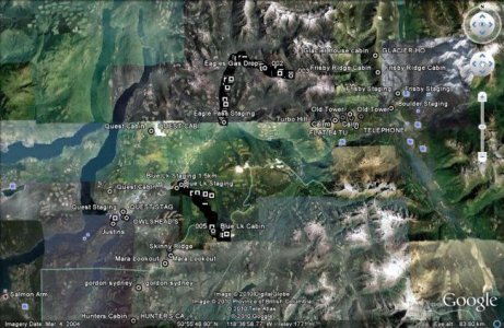
I use my Rhino every time I ride. I keep it in my handlebar bag and log the tracks that I make on any given day. As I don't have an altimeter on my sled I often use it to check elevations and verify clutching. When I get back from sledding I download my tracks and waypoints from the GPS into mapsource then save them as a .gpx file. This allows you to import them into Google Earth and check out where you've been. I've attached a sample of the gps tracks in Google earth.
As far as maps are concerned if you're riding in BC the only one worth having is the Canadian Topographic Map from Garmin. A lot of the logging roads are on them. I bought an 8 Gig SD card for my Rhino, that is enough storage to hold all of the Topo maps for Western Canada so you don't have to worry about loading maps for every particular area you sled in.
Oil Trax NT is great for Alberta but it has next to no coverage in BC (Except NE BC). I find that the coverage for Oil Trax is best around Grande Prairie where every goat trail around seems to be on there. I have Oil Trax loaded on a different SD card so when I want to change maps I don't have to do any loading I just pop off the battery, switch the card and reboot the device.
As far as a radio channel it all is your preference our group runs channel 6 code 1 but I think it doesn't matter as long as everyone is on the same channel. Sometimes I think it would be nice to have everyone on one channel incase the chit really hit the fan... it would be easier to call for help but I guess that's what a spot or sat phone is for....
Well thats about all I have right now if anyone has any questions feel free to ask me.
wow. you've got it going man. I'll have to get in contact with you some day and get you to teach me this stuff, Really interested in ploting some of my tracks on Google earth.


